Location
The ultimate travel destination in America and one of the most famous natural wonders in the world. The magnitude of Grand Canyon compels even the most jaded traveler to pause and draw breath.
The Grand Canyon is 277 miles (446 km) long, up to 18 miles (29 km) wide and attains a depth of over a mile (6,000 feet / 1,800 metres). The Colorado River started to carve the canyon already 17 million years ago and nearly two billion years of the Earth's geological history have been exposed as the river has cut its channels through the rock layer after layer.
Grand Canyon National Park attracts about five million visitors per year. The North and South Rim of the Grand Canyon offer quite different experiences. The South Rim is more popular as it has easier access, more services and world famous vistas. At 1000ft higher than the South Rim, the North Rim cooler and has less crowds. The cooler air also suppoprts vegetation such as wildflower meadows, thick stands of aspen and spruce.
Activities
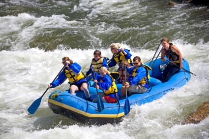
Aside from casual sightseeing from the South Rim (averaging 7,000 feet [2,100 m] above sea level), rafting, hiking, running and helicopter tours are especially popular. The floor of the valley is accessible by foot, muleback, or by boat or raft from upriver. Hiking down to the river and back up to the rim in one day is discouraged by park officials because of the distance, steep and rocky trails, change in elevation, and danger of heat exhaustion from the much higher temperatures at the bottom. Rescues are required annually of unsuccessful rim-to-river-to-rim travelers. Nevertheless, hundreds of fit and experienced hikers complete the trip every year.
Camping on the North and South Rims is generally restricted to established campgrounds and reservations are highly recommended, especially at the busier South Rim. There is at large camping available along many parts of the North Rim managed by Kaibab National Forest. Keep in mind North Rim campsites are only open seasonally due to road closures from weather and winter snowpack. All overnight camping below the rim requires a backcountry permit from the Backcountry Office (BCO). Each year Grand Canyon National Park receives approximately 30,000 requests for backcountry permits. The park issues 13,000 permits, and close to 40,000 people camp overnight. The earliest a permit application is accepted is the first of the month, four months before the proposed start month.
View Points
There isn't really a single best Grand Canyon view. Each location is unique and offers a new insight. The Grand Canyon changes from every view point you visit. Best advice is perhaps to visit not only one view point but several so you can observe how monuments and temples make entrances and exits and change shape as you change yorur angle of view.
Most Grand Canyon visitors will experience the Canyon from the Canyon's edge at one of the official view points. At the South Rim, these are set along either the West or East Rim Drives.
Tourists wishing for a more vertical perspective can board helicopters and small airplanes in Las Vegas, Phoenix and Grand Canyon National Park Airport (seven miles from the South Rim) for canyon flyovers. Scenic flights are no longer allowed to fly within 1500 feet of the rim within the national park because of a late 1990s crash. Maverick Helicopter offers a tour that descends and lands 3,500 feet into the Grand Canyon in Hualapai Indian Territory.
The nearest major airports are in Phoenix and Las Vegas, and the most convenient way to get to the canyon from either airport is to rent a car and drive. You can get to the south rim from basically two directions, from Williams (60 miles south of the rim) or from Flagstaff (80 miles southeast of the rim).
From Williams. Take I-40 to Route 64 and head north about 63 miles (Interstate 40).
From Flagstaff. There are 3 ways to the South Rim from Flagstaff about 80 miles.
1. Take Hwy 180 West to Route 64 and head north.
2. Take I-40 West to Williams. Take Route 64 and head north.
3. Take Highway 89 North to Route 64 West to the Desert View East Entrance.
There are also shuttle buses:
Flagstaff Shuttle. Flagstaff Express Shuttle offers shuttle service to and from Grand Canyon.
Open Road Tours. Open Road Tours offers shuttles to the Canyon from Flagstaff
Many of the view points can be accessed via the free National Park Service Shuttle Buses. In fact, the West Rim view points can only be reached by Shuttle Bus, or on foot.
Single-visit entrance fees are good for seven days and are charged either by the carload or individually. The vehicle pass costs $25. The individual pass for pedestrians, bicyclists, and motorcyclists costs $12. As part of the National Parks system, the Grand Canyon National Park also accepts National Park Passes, Hologram upgrade, Golden Age Passports, and Golden Access Passports.

