Ramona Falls

TomassoRizzi's picture

Location

Oregon
United States
45° 22' 47.424" N, 121° 46' 33.276" W
US
General info: 

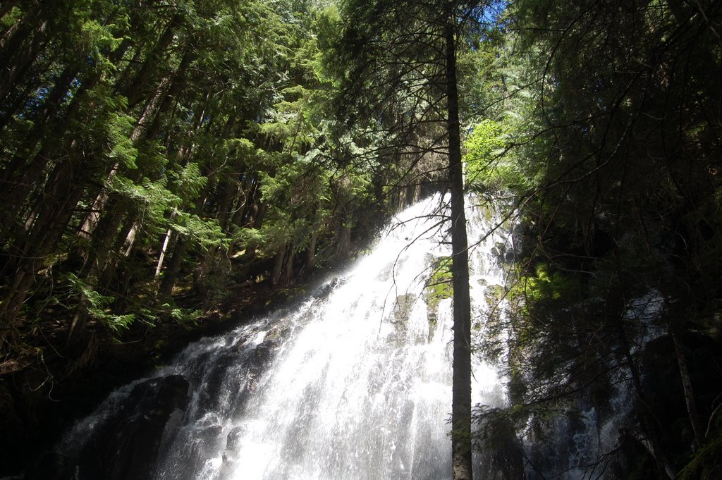
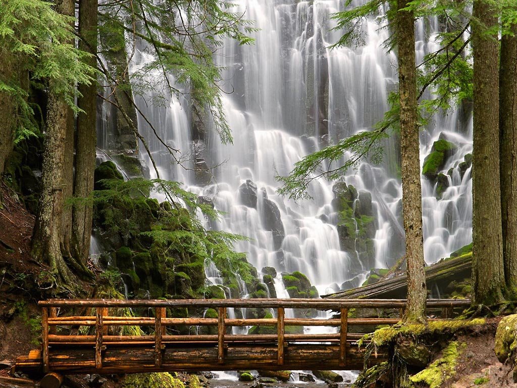
Ramona Falls drops 120 feet, cascading and splitting into ever smaller drapes broken up by the hexagonal columns of basalt at the base of the cliff. The special shape of the columnar basalt was formed in a lava eruption.

There is an 11,7km long loop trail to the falls. The south leg of the loop is less scenic but the north leg after the falls really enjoyable following the lush, green path of Ramona Creek and skirting towering cliffs before veering south to head back towards the trailhead.

Getting there: 

There is an 11,7km long loop trail to the falls. The trail is moderate difficulty and takes about half a day to hike (4-6 hours). The trailhead is at the end of Muddy Fork Road and features a big gravel parking area.

NOTE: Not recommended to hike this trail during winter because a critical, temporary bridge early in the trail is removed each winter.

Costs: 

National Forest Recreation Pass - $5.00

You might be interested in

Out of crazy walkways, this has got to be one of the craziest. Near the top of the Tianmen Mountain, on a sheer rock face goes this 60m long walkway.

The aptly named Half Dome is possibly Yosemite's most familiar rock formation. The granite crest rises more than 4,737 ft (1,444 m) above the valley floor and the drop from the top is nearly vertical.

The White Cliffs of Dover are one of England’s most recognizable landmarks. The sheer cliffs of white chalk mark the closest part of England and reach up to 350 feet (110 m).

Devils Tower is the most improbable rock formation rising dramatically 1,267 feet (386 m) above the surrounding terrain with summit 5,114 feet (1,559 m) above sea level.

Europe's largest high alpine meadow, Alpe di Siusi, separates two of the most famous Dolomite ski-resort valleys (Val di Fassa and Val Gardena).

The water pouring down from a flat-topped plateau Auyán-Tepuí creates a sight that is best described as completely epic. The huge waterfall in middle of rainforest looks like a scenery from a sci-fi movie.

Interesting places nearby

BASE: 5800ft
SUMMIT: 7200ft
VERTICAL DROP: 1400ft

NO. OF. LIFTS: 3
Gondolas: 0
Chairs: 2
Surface: 1

Soda Springs is one of America's original ski resorts, established in 1931. It has become a cost-saving alternative to the larger Lake Tahoe resorts.

Who cares about snowmaking machines when daytime temperatures in B.C.'s Okanagan Valley – home to Silver Star Resort – stays at -3 Celsius (27 Fahrenheit) and keeps light, powder snow under those slats and boards.

Silver Mountain sits on the Bitterroot Range in the heart of Idaho's mining country, in the panhandle of Northern Idaho. There are two separate mountains: Kellogg and Wardner Peaks.

Since its inception in 1946, Sierra-at-Tahoe Resort has grown into its role as one of Lake Tahoe's largest resort areas. Sierra-at-Tahoe features 14 chairlifts that access 2000 acres of skiable terrain and 2,212 feet of vertical.

You'll find Schweitzer in Idaho, but just 86 miles northeast of Spokane, Washington.