Half Dome, Yosemite

Location

Yosemite Valley
United States
37° 44' 44.772" N, 119° 32' 1.176" W
US
General info: 

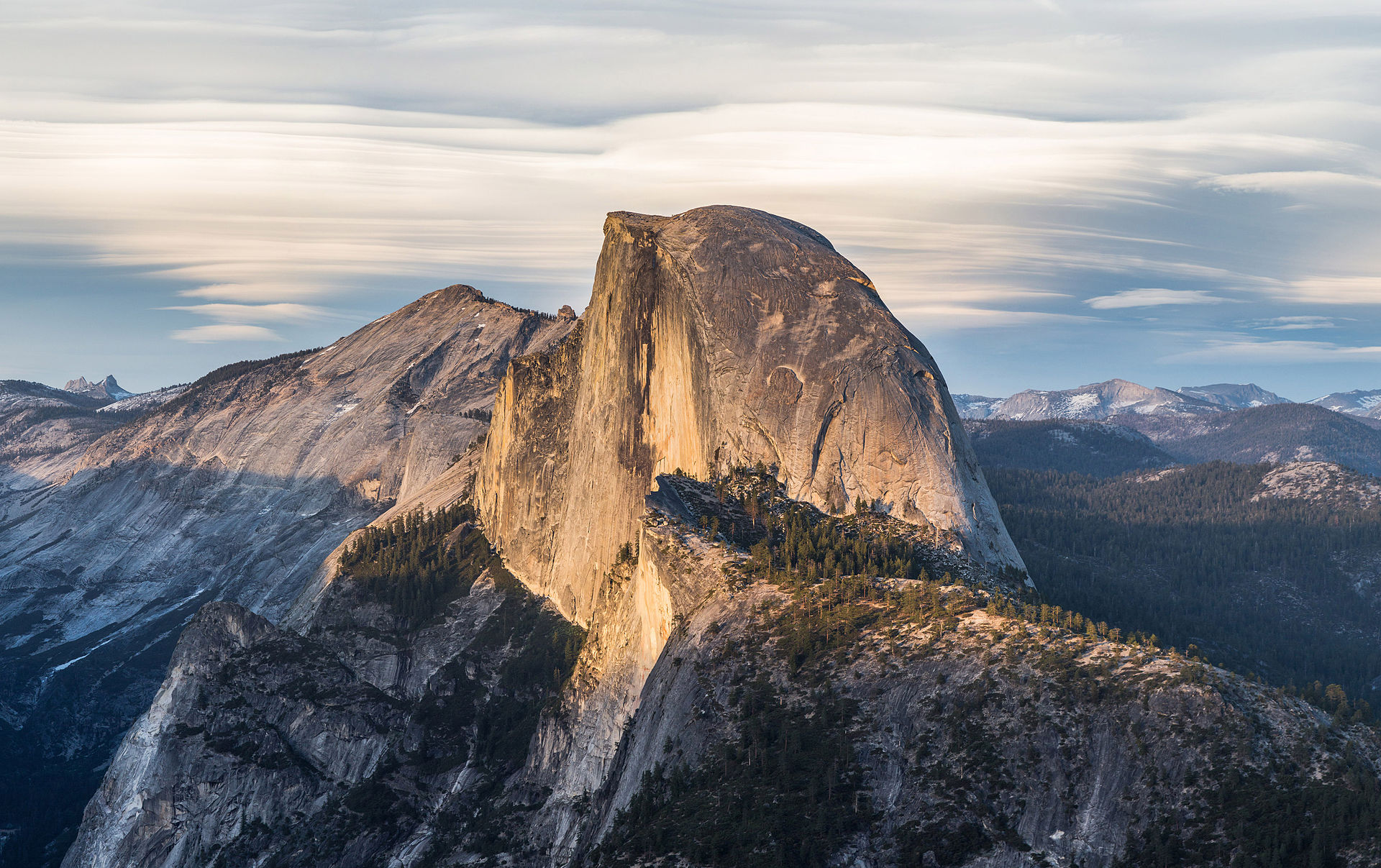
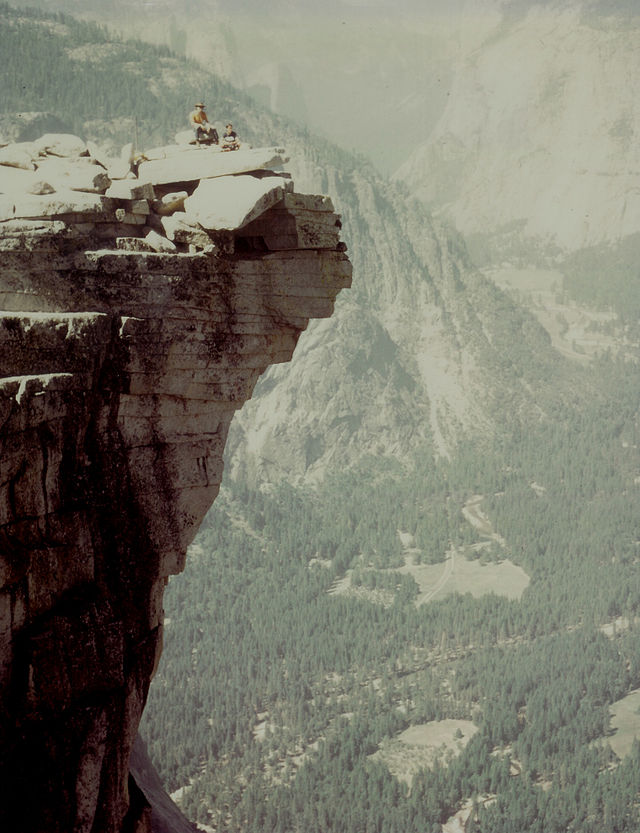
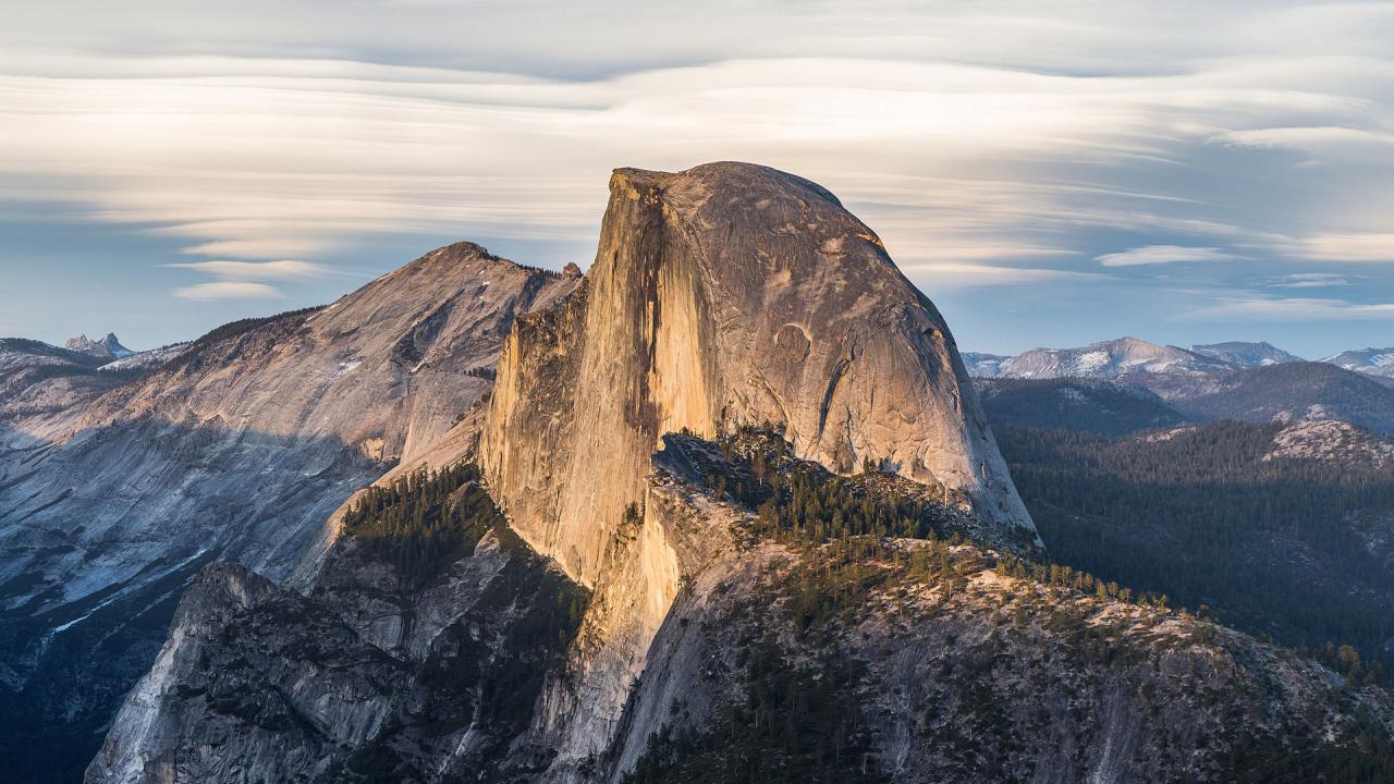
The aptly named Half Dome is possibly Yosemite's most familiar rock formation. The granite crest rises more than 4,737 ft (1,444 m) above the valley floor and the drop from the top is nearly vertical. Hiking to the summit is not for everyone but those taking the effort are rewarded by incredible views over the Yosemite National Park.

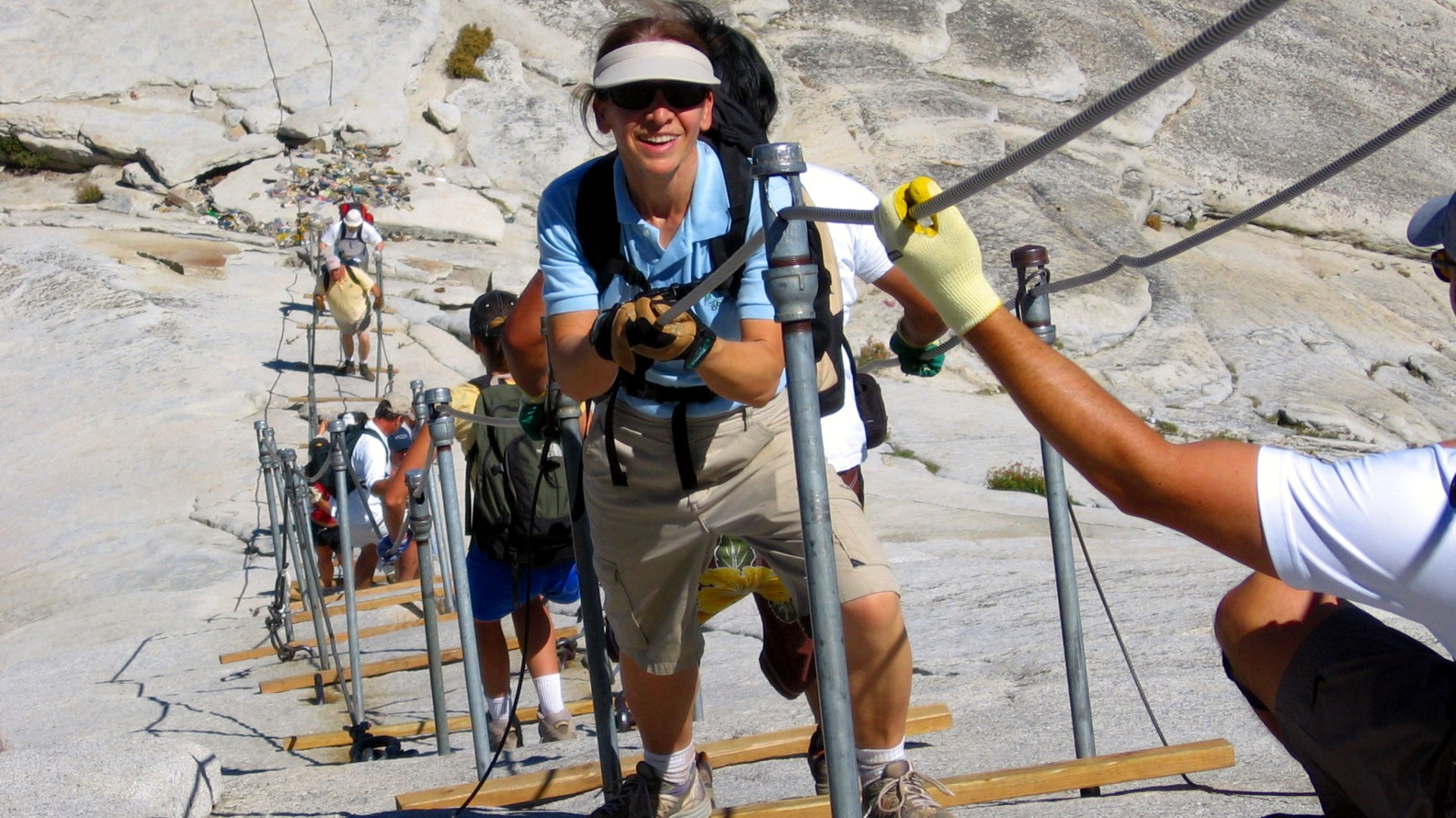
There are several hiking routes in the area and the top of the dome is accessible even without climbing gear. This is made possible by a cable system installed in the last 400 feet to the summit in 1919. Since 1919, relatively few people have fallen and died on the cables.

Due to the crowds, the park authorities have introduced a permit system to access the cable section of the trail.

Getting there: 

The 14- to 16-mile round-trip (depending on the route) takes most people 10-14 hours to hike. If you are planning to hike to the summit, you will need a permit to do the cable section of the trail. The permit lottery is once a year around March. Additional 50 permits per day are issued always two days in advance, again by lottery. The permits are easier to get for weekdays, and much easier to get for September and October. Applying for lottery:

http://www.recreation.gov/permits/Cables_On_Half_Dome/r/wildernessAreaDe...

There is a parking lot right next to the trailhead. If the trailhead lot is full, you can park at Curry Village. There is also a free shuttle bus from the other Yosemite parking lots to the trailhead. Just note that the buses don't start running until 7 a.m. in case you are planning an early start.

Hiking to the top is possible only when the cables are on place. The cables usually go up in May the weekend before Memorial Day weekend and come down after Columbus Day weekend in October.

Costs: 

Entering the permit lottery costs $4,5 and the winners need to pay an additional $8 to get the permit.

You might be interested in

Out of crazy walkways, this has got to be one of the craziest. Near the top of the Tianmen Mountain, on a sheer rock face goes this 60m long walkway.

The White Cliffs of Dover are one of England’s most recognizable landmarks. The sheer cliffs of white chalk mark the closest part of England and reach up to 350 feet (110 m).

Devils Tower is the most improbable rock formation rising dramatically 1,267 feet (386 m) above the surrounding terrain with summit 5,114 feet (1,559 m) above sea level.

Europe's largest high alpine meadow, Alpe di Siusi, separates two of the most famous Dolomite ski-resort valleys (Val di Fassa and Val Gardena).

The water pouring down from a flat-topped plateau Auyán-Tepuí creates a sight that is best described as completely epic. The huge waterfall in middle of rainforest looks like a scenery from a sci-fi movie.

Is it serious when a glacier bleeds? Not necessarily. It might be the Blood Falls in East Antarctica. This five-story high, blood-red waterfall pours slowly out of the Taylor Glacier.

Interesting places nearby

Perched atop Tahoe’s Donner Summit, Sugar Bowl Resort is the closest major resort to Sacramento and the Bay Area.

Squaw Valley USA, site of the Winter Olympic Games in 1960, is a legendary vacation destination plunked down squarely at the end of a gorgeous Sierra valley.

Snowbird has the largest vertical rise in Utah and is among the top ten in the nation.

Often overlooked because of the famous resorts in Park City and the Cottonwood Canyons, Snowbasin is a gem of a resort, located 45 minutes from the Salt Lake International Airport and eight miles from Ogden Valley.

Far from the crowds at other resorts, 12 miles up Big Cottonwood Canyon is a whole different world where the sense of calm and peacefulness might be described as “solitude.” Solitude Mountain Resort has celebrated their Golden Anniversar

BASE: 5800ft
SUMMIT: 7200ft
VERTICAL DROP: 1400ft

NO. OF. LIFTS: 3
Gondolas: 0
Chairs: 2
Surface: 1