Location
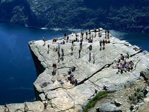
Preikestolen
Location

Preikestolen is a unique rock formation towering 604 meters over the Lysefjord near Stavanger. The top of the rock is completely flat with an area of 25mX25m and it looks like the whole block is cut with a knife.
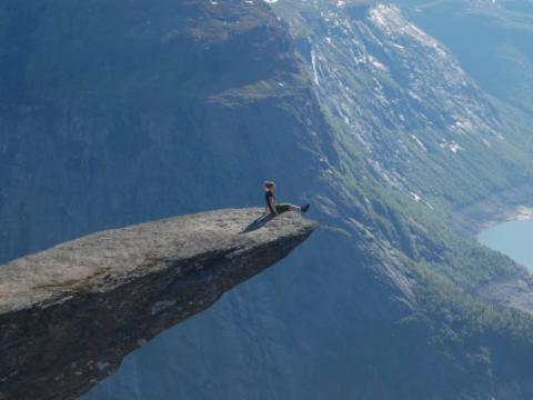
Trolltunga
Location
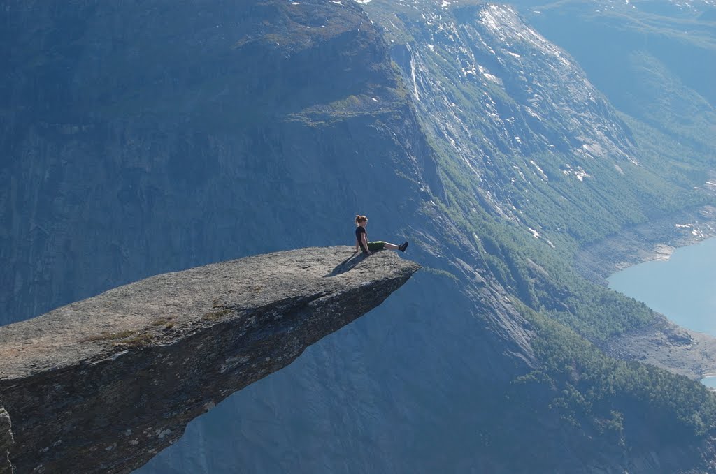
Trolltunga (Troll's tongue) is a piece of rock jutting horizontally out of a mountain a staggering 700 metres above the lake Ringedalsvatnet in Odda, Norway. Standing on this natural formation, hovering so high over nothing, feels incredible. At the same time it is uncomfortable, knowing that any wrong move would be fatal.
The Trolltunga was formed around 10 000 years ago in the ice age when glacial water froze a hunk of this mountain and caused it to break off. The piece that is left is what locals call private://the troll's tongue.private://
It is a popular hiking destination and obviously extremely dangerous with no safety railings what so ever.
Tianmen Mountain Glass Walkway
Location

Out of crazy walkways, this has got to be one of the craziest. Near the top of the Tianmen Mountain, on a sheer rock face goes this 60m long walkway. The path attached to the vertical cliff is 3ft wide and right under your feet is a nice 1km drop. If this is not terrifying enough, the path is made of glass allowing a crystal-clear view of where you will plummet is something goes wrong.
Looking at the visitors on the bridge, it seems that some of us forget how to walk normally when walking on the glass path. If you are brave enough to take the walk, you are rewarded with the gorgeous views over the canyon.
Half Dome, Yosemite
Location
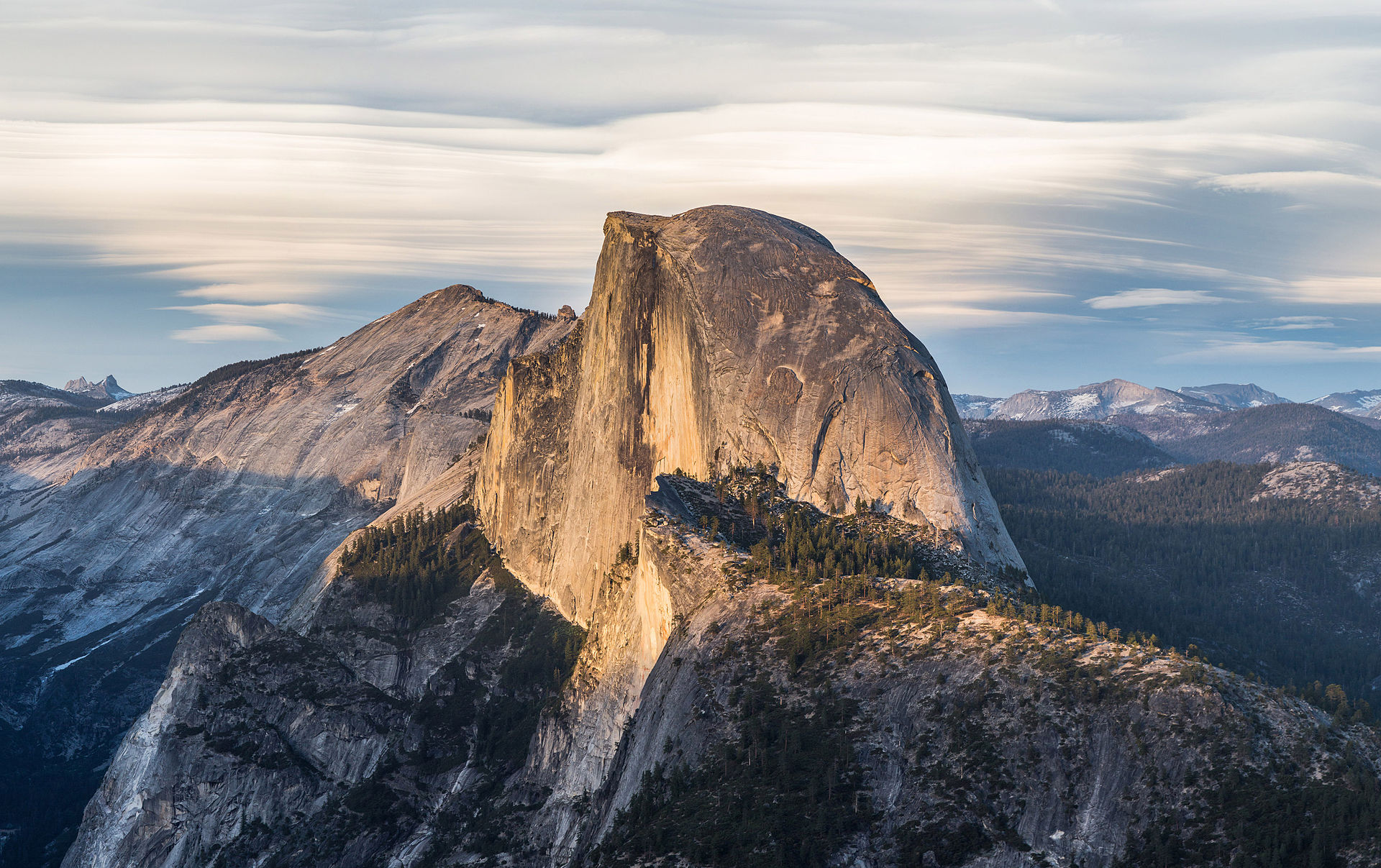
The aptly named Half Dome is possibly Yosemite's most familiar rock formation. The granite crest rises more than 4,737 ft (1,444 m) above the valley floor and the drop from the top is nearly vertical. Hiking to the summit is not for everyone but those taking the effort are rewarded by incredible views over the Yosemite National Park.
There are several hiking routes in the area and the top of the dome is accessible even without climbing gear. This is made possible by a cable system installed in the last 400 feet to the summit in 1919. Since 1919, relatively few people have fallen and died on the cables.
White Cliffs of Dover
Location
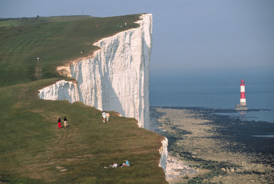
The White Cliffs of Dover are one of England’s most recognizable landmarks. The sheer cliffs of white chalk mark the closest part of England and reach up to 350 feet (110 m). The cliffs spread 10 miles east and west from the town of Dover
For centuries the cliffs of Dover have been a symbol of Englands defiant spirit, standing watch over the Channel. However the cliffs are slowly crumbling away due to erosion by waves, rain, wind and freezing. The cliffs retreat at an average rate of about half an inch a year. Bigger collapses take place occasionally, last time in 2012.
Devils Tower
Location
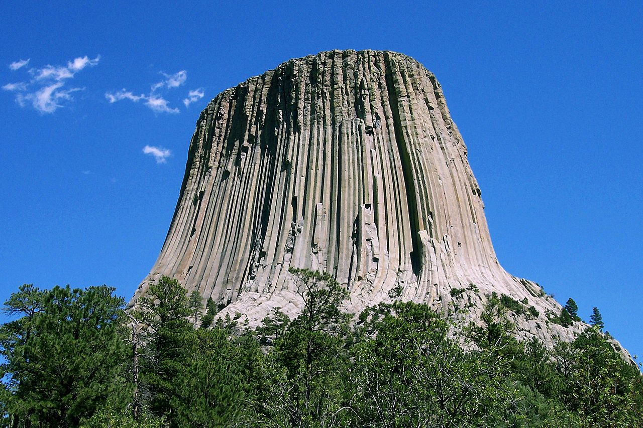
Devils Tower is the most improbable rock formation rising dramatically 1,267 feet (386 m) above the surrounding terrain with summit 5,114 feet (1,559 m) above sea level.
It was the first declared United States National Monument, established in 1906. For Native Americans it has been a sacred place from ancient times.
It is not completely certain how the mountain has been formed. Most common theories say that it is either a laccolith or a volcanic plug. In either of the cases Devils Tower is formed of molten rock that has cooled and become solid igneous rock. It did not visibly protrude out of the landscape until the overlying sedimentary rocks eroded away.
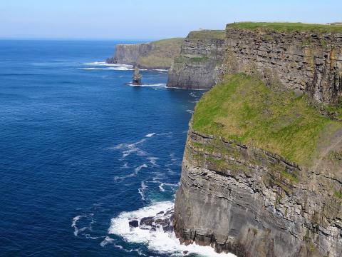
Cliffs Of Moher
Location

The Cliffs Of Moher are the most outstanding coastal features of Ireland. They rise 120 metres (390 ft) above the Atlantic Ocean at Hag's Head, and reach their maximum height of 214 metres (702 ft) just north of O'Brien's Tower, eight kilometres to the north.
The cliffs form a continuous rocky wall and provide an unrivaled view across the wildness of the Atlantic Ocean and the Clare coastline. They consist mainly of beds of Namurian shale and sandstone and it is possible to see 300 million year-old river channels cutting through the base of the cliffs.
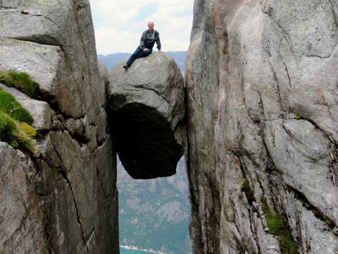
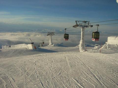
Kjerag and Kjeragbolten
Location

On the other side of the Fjord from Preikestolen is another breathtaking cliff, Kjerag. Its highest point is 1110 m above sea level, but it is the northern drop to Lysefjorden that attracts most visitors. The drop to the fjord is a stunning 984m (3,228 ft). Kjerag is a popular hiking and climbing destination and many go there because Preikestolen has become a bit crowded. Kjerag is also popular among BASE jumpers around the world but they won’t add to the crowd too much as most of them jump off the high cliffs as soon as they get there. Wedged in a crevace of Kjerac there is also a famous boulder called Kjeragbolten.
Mount Asgard
Location
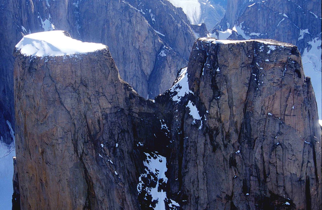
Mount Asgard is a twin peaked mountain with two flat-topped, cylindrical, rock towers, separated by a saddle.
At 2015m, it is one of the highest peaks in Eastern Canada. It is the unique features however that set Asgard aside from the rest. The flat tops towering 1600m above the valley floor, the 1 kilometer tall twin vertical faces and the cylinder shape create a majestic sight.
Most difficult climbing routes on Baffin Island can be found on Mt. Asgard. The North peak was first climbed in 1953 and the south summit in 1971.
Mount Thor
Location
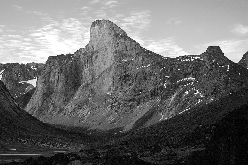
Mount Thor on Baffin Island is a granite peak that features the world’s tallest purely vertical drop.
The complete height of the mountain is only 1675 metres (5,495 ft) but the vertical drop is an unbelievable 1,250 m (4,101 ft). To put this height in context the world’s tallest building Burj Khalifa is 828m and the Empire State Building is 381m. Thor's uninterrupted west face is considered by some to be the largest on earth. The average grade of the wall is 105 degrees so it is slightly overhanging. This feature makes Thor a fairly popular rock climbing site, despite its remote location.
Étretat Cliffs
Location
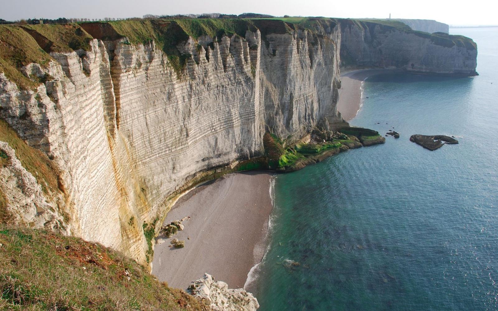
The astonishingly vertical cliffs of the Alabaster Coast are most picturesque in the small town of Etretat. The cliffs are up to 70m high and create a perfect contrast with the plateau of the Pays de Caux above the cliffs. Looking from the edge of the cliffs you will have an endless bird's-eye view of the coast.
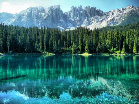
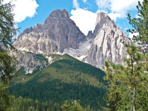
Trango Towers
Location
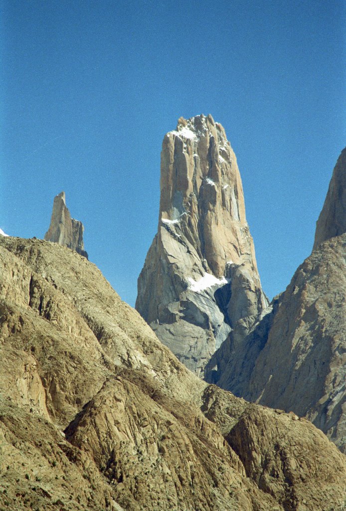
The Trango Towers is a group of tall granite spikes located in northern Pakistan. The Towers offer some of the largest cliffs and most challenging rock climbing in the world. Visually the most dramatic peak is the Nameless Tower that sticks out like a tower should(featured in the main photo). The highest point in the group is the summit of Great Trango Tower at 6,286 m (20,608 ft). The East Face of the Great Trango Tower features the world's greatest nearly vertical drop at 1340m(4,396 ft).